Location
Tiruvannamalai District came into existence on 30th September 1989 after the bifurcation of the erstwhile North Arcot District. The district lies between 12° 00' and 12° 49' North latitude and 78° 38' to 79° 45' East longitude. The district is bounded on the north and west by Vellore District, on the southwest by Dharmapuri District, on the south by Villupuram District, and the east by Kanchipuram District.

Total Area
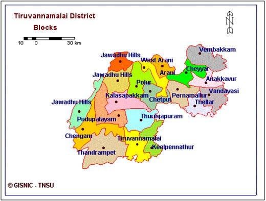
The total geographical area of the district is 6191 Sq Kms, comprising the Revenue Divisions of Thiruvannamalai and Cheyyar. The district has six taluks viz. Thiruvannamalai, Chengam, Polur, Arni, Cheyyar and Vandavasi. There are 18 Blocks, including one tribal Block, Jawadhi Hills constituting the district under Rural sector and four Municipalities viz. Thiruvannamalai, Arni, Cheyyar (Thiruvathipuram), Vandavasi representing urban sectors along with Polur selection grade Town Panchayat.
Aim
Holistic Advancement of the Rural and the Marginalized
Vision
Integral formation of the Rural and Marginalized youth to work towards participatory Village Development initiatives in order to give a new orientation to the upliftment process of the Subaltern groups with special preference to the SC/ST.
Mission
To animate and organize the Youth in and around Thiruvannamalai district for self-development and to activate them as catalysts and productive contributors for their own Rural and Marginalized communities. DB SIHARAM will involve in the facilitation process of self- realization for the youth and organization of the rural youth in Thiruvannamalai district through the various educative, employment and empowerment schemes offered here.